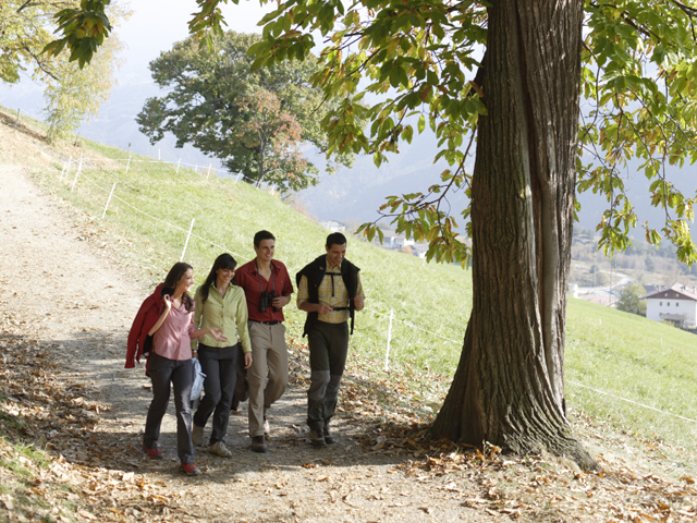
Hiking in our Neighbourhood
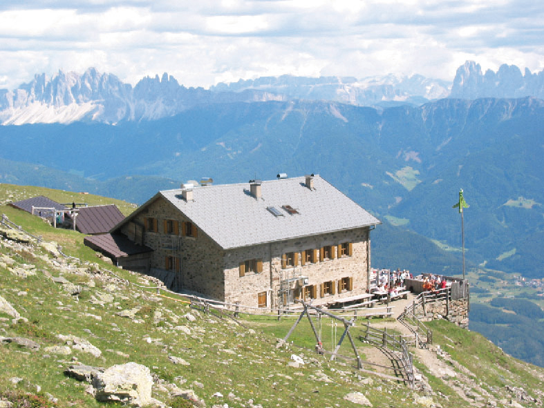
Mountain Refuge Lago Rodello
Refuge Lago Rodella features accommodations in double, triple and quadruple rooms, plus a large camp. Culinary tip: Dumpling Day is every Thursday, when Christian Gshnitzer and his team serve up fresh South Tyrolean dumplings called Knödel. Garner Wetterkreuz Parking Area: Trail No. 10, walking time: 2 hours. Kühhof Parking Area: Trail No. 10B/10 to Radlsee, walking time: 2 hours. Kühhof Parking Area: Trail No. 1 past Klausnerhütte on the Trail No. 8/10 ascent to Rifugio Lago Rodella/Radlseehütte, walking time: 3 hours. Zoler Parking Area: Trail No. 18, walking time 2 1/2 hours. Caredo/Gereuth - Perlunger Parking Area: Trail No. 8/8B/18, walking time 2 1/2 hours.
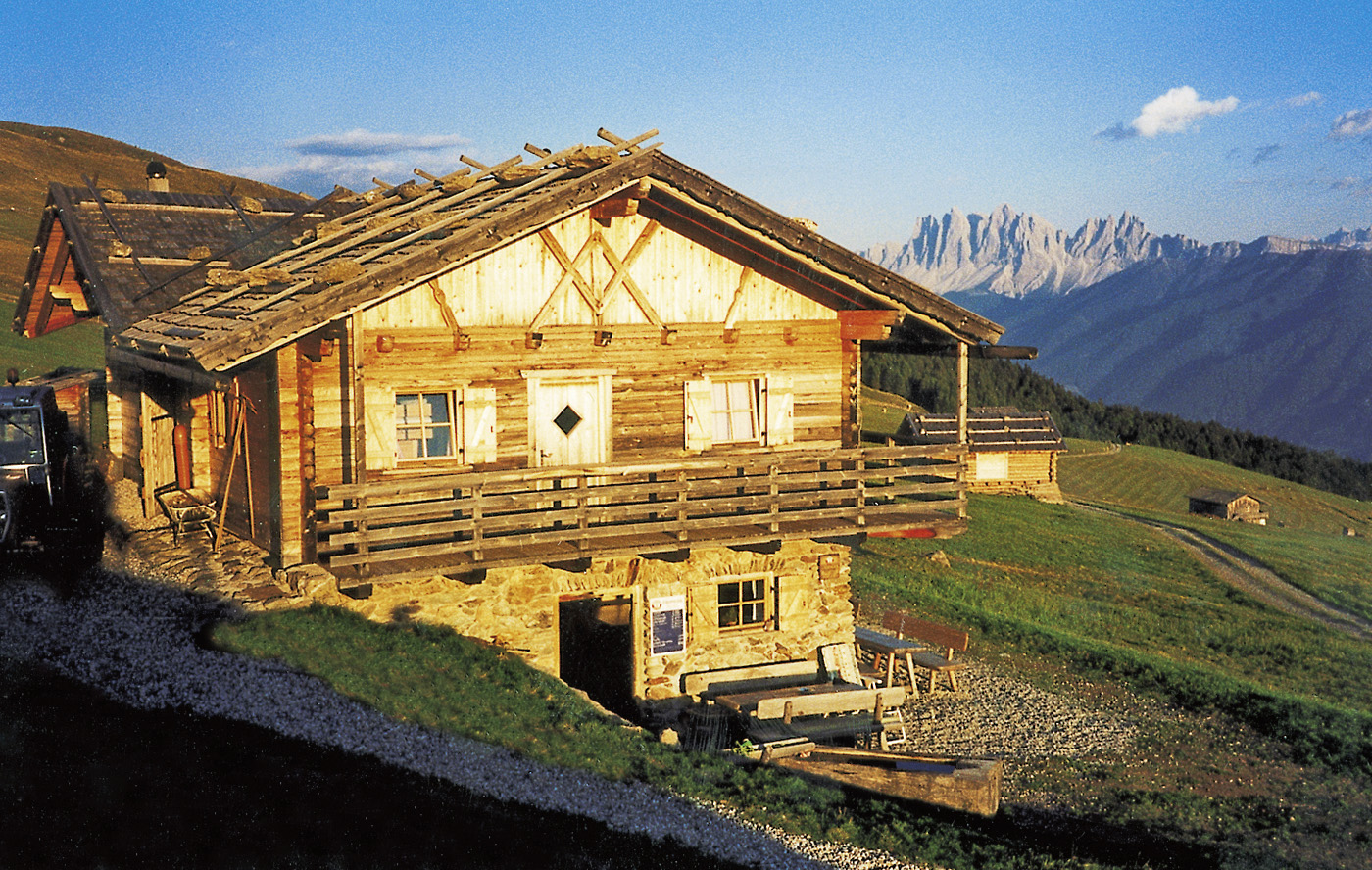
Brugger Schupfe
The approach is via Velturno/Feldthurns near Caerna/Garn and continues on to the Garner Wetterkreuz parking area. From there, it is about an hour-long hike to Brugger Schupfe, which may entice you to linger awhile in the sun or enjoy some delicious treats in the cosy wooden farmhouse Stube parlour. If you don’t have a toboggan with you, you can rent one from the proprietor. Then it’s off down the 5-kilometre-long, well-groomed
Tide: 2 h
High difference: 571 hm
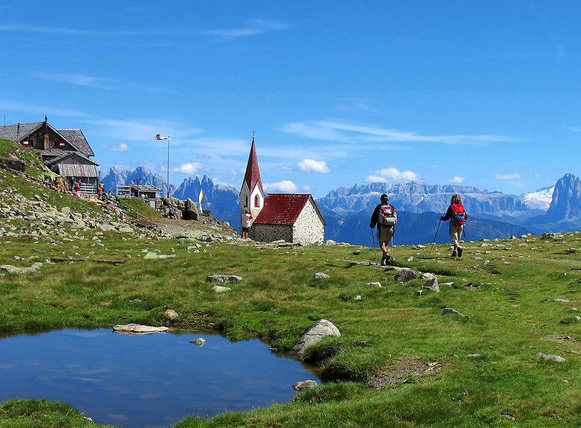
Villanderer AlmOne of Europe’s largest alpine pastures
Villanderer Alm, one of Europe’s largest alpine pastures, is undoubtedly one of South Tyrol’s most popular hiking areas. The mostly flat Alm alpine pastureland, which has a surface area of about 20 square kilometers, offers many hiking trails and a wealth of unspoiled nature at elevations between 1,700 and 2,500 meters.
The Villanderer Alm circuit trail, for example, runs along undemanding paths to the most beautiful spots on this vast plateau. Hikers will be amply rewarded with fantastic views of the Dolomites, the Rieserferner Gruppe and the Zillertal Alps.
At the mountain huts of Villanderer Alm, hungry hikers can enjoy South Tyrolean specialties and sun terraces with panoramic views.
Man has left his mark here for centuries, if not millennia: The trail leads past the Am Toten Chapel, and the path leading to it follows the old Stations of the Cross. A little further from the Schwarzseen Lakes, you’ll find the remains of a mine dating from the sixteenth century.
"Keschtnweg": Eisacktal Chestnut Trail
On the path of the South Tyrolean chestnut A line of chestnut groves extends from the abbey of Novacella/Neustift near Bressanone/Brixen all along the slopes of the Isarco Valley as far as the high plateau of the Rittner and down into the Bolzano/Bozen valley as far as Runkelstein castle with its fabled frescoes: the ideal route for the “Keschtnweg”. It should not only be thought of as an Autumn excursion though, because the landscape is extremely attractive all year round thanks to the diverse vegetation of the area. The well marked route leads through mixed forests vibrant with colour, lush green meadows and imposing chestnut groves – a very special experience.
Along the "Keschtnweg" Sellers of Local Produce offer regional products for sale.
The chestnut
In Europe the chestnut , more than most other species of tree, has performed a distinct and vital service; so important that it has earned the right to be known as “Brotbaum” - bread tree (until modern times the chestnut provided nourishment for at least 6 months of the year). The vital importance of this type of tree, even at our latitude, is still well known thanks to a variety of writings and sayings.
The "Keschtnweg" is especially popular during the season of "Törggelen" .